Indeks: Historic Maps and Views of Londo
Dostępność: na zamówienie The 24 unique, fascinating, and beautiful maps and views in this book date from the 12th century to the present, including some of the earliest known maps of London as well as topographical maps, views of iconic locations and monuments, transit maps, maps used for advertising, road and bicycle maps, and much more.
Dostępność: na zamówienie The 24 unique, fascinating, and beautiful maps and views in this book date from the 12th century to the present, including some of the earliest known maps of London as well as topographical maps, views of iconic locations and monuments, transit maps, maps used for advertising, road and bicycle maps, and much more. The images have been carefully selected by photographic historian George Sinclair, who traveled across Europe to mine some of the most obscure historical collections for a wide variety of unique, never-before-published, and visually and historically intriguing images. Every map or view includes the original printing information on the back and is accompanied by brief text that places the image in its historic context and further illuminates its qualities. In addition, Sinclair provides a thoughtful introduction to the collection of images. Printed on high-quality matte paper and exquisitely reproduced, these images are perfect for display in any home, office, library, dorm room, or classroom.
Czy barwa to zjawisko tylko psychofizjologiczne? Czy ma ona wpływ na uczucia? Ta żywo napisana książka, kolejna po nagrodzonym tytule Kolor i kultura, jest przesiąknięta przekonaniem, że znaczenie barwy tkwi w jej historycznym kontekście; zależy od tego, kiedy jest ona odbierana i interpretowana. John Gage zgłębia tajemnice tematów tak odległych od siebie jak techniki optycznego mieszania używane w mozaikach, związki barwy i języka w Ameryce Łacińskiej w czasie jej podboju przez Hiszpanów oraz idee Goethego, Rungego, Blake'a i Turnera.
Tom poświęcony architekturze nowoczesnej składa się z sześciu studiów, będących skróconymi wersjami prac magisterskich przygotowanych na prowadzonym przeze mnie seminarium z historii sztuki nowoczesnej. Zasadnicza część tomu poświęcona została architekturze Pomorza przełomu XIX i XX wieku oraz okresu międzywojennego, a także architektom i budowniczym związanym z tym terenem. Przedmiotem studiów są więc wartoąciowe artystycznie budynki i zespoły architektoniczno-urbanistyczne w Toruniu, Sopocie i Juracie, a także ich twórcy, jak Paul Puchmüller, Julius Habicht czy Tadeusz Zandfoss.
Wytrzymałość materiałów to dział mechaniki, będących jedną z podstawowych dziedzin wiedzy, stanowiący przedmiot nauczania studentów uczelni technicznych na wydziałach: Budownictwo lądowe, mechaniczny, górniczy, inżynierii środowiska. Podręcznik "Wytrzymałość materiałów. Ćwiczenia" jest polecony studentom i dydaktykom tych wydziałów. Stanowi on efekt wieloletniej pracy dydaktycznej i poczynionych w jej trakcie obserwacji i przemyśleń autorki - dr inż. Grażyny Anny Palczak.
Opracowanie metody pomiarów i badań historycznych zabytków architektury stanowi podsumowanie doświadczeń zdobywanych w pracach realizowanych pod kierunkiem bądź z udziałem autorki, przede wszystkim w Zakładzie Architektury Polskiej Wydziału Architektury PW. Oryginalny temat został został przedstawiony z punktu widzenia architekta i opiera się na założeniu, że architektura zabytkowa wraz z otoczeniem stanowi ważne źródło historyczne, a metody badań naukowych wynikają z faktu jej przynależności zarówno do historii sztuki, jak i techniki.
Ze wstępu: "Niniejsza monografia tematycznie związana z 50-leciem Wydziału Achitektury Politechniki Krakowskiej jest opracowaniem o szczególnym znaczeniu, ilustrującym dorobek i twórczą kontynuację tradycji Szkoły Krakowskiej zarówno w zakresie badań naukowych, kształcenia architektów i urbanistów, jak i działalności projektowej i twórczej.
Już od 28 czerwca 2015 r. znikają kolejne bariery w procesie budowlanym. Warto wiedzieć, jakich ułatwień mogą spodziewać się inwestorzy. Z drugiej strony nowe przepisy nakładają dodatkowe obowiązki na administrację architektoniczno-budowlaną, przede wszystkim na starostów. Po wejściu w życie zmian można budować dom bez pozwolenia na budowę, ale więcej informacji na temat inwestycji i samego inwestora znajdzie się w internetowych i powszechnie dostępnych rejestrach. Co przyniosą nowe zmiany? Czy spowodują, że łatwiej będzie budować i oddawać do użytku obiekty budowlane? Autorzy opracowania szczegółowo skomentowali każdy przepis Prawa budowlanego, zmieniony nowelizacją z dnia 20 lutego 2015 roku (Dz.U. z 2015, poz. 443), a zmiany w treści ustawy zostały dodatkowo wyróżnione.
Książka z płytą. Skrypt jest przede wszystkim instrukcją obsługi arkuszy kalkulacyjnych, opracowanych przez autora, a wspomagających rozwiązywanie problemów z zakresu mechaniki budowli. Wzory arkuszy umieszczono na płycie CD, dołączonej do książki
Systemy komputerowego wspomagania wytwarzania są coraz powszechniej stosowane w przemyśle. Zwiększający się stopień skomplikowania produktów i coraz bardziej wyrafinowane wzornictwo wymagają użycia zintegrowanych, nowoczesnych narzędzi CAD do projektowania, CAE do symulacji i CAM do wytwarzania — narzędzi, za pomocą których można szybko wdrażać i modyfikować idee projektantów. NX (dawna nazwa: UNIGRAPHICS) to zintegrowany system wyższego rzędu, stanowiący kompleksowe rozwiązanie z zakresu CAD/CAM/CAE. Oferuje on dostęp do innowacyjnej techniki modelowania Synchronous Technology.
Niektóre zresztą są prawie nieprzystępne na rynku. Przyczyny te skłoniły autorów niniejszej książki do podjęcia tematu i ukazaniu zarysu europejskich i polskich tradycji architektury i sztuki ogrodowej w kontekście przemian społeczno-ekonomicznych.
Są one tworem architektonicznych wizjonerów XX wieku, takich jak: Mies van der Rohe, Frank Lloyd Wright, Shina Takamatsu, Shigeru Bana. Te jedyne w swoim rodzaju arcydzieła architektury są odzwierciedleniem czasów w jakich powstały. Tym, co łączy wszystkie projekty architektoniczne, jest relacja między klientem a architektem…
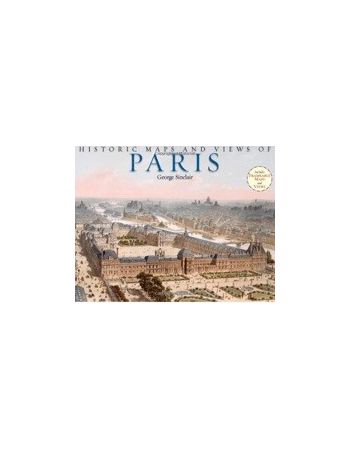
Dostępność: niedostępne The 24 unique, fascinating, and beautiful maps and views in this book date from the 12th century to the present, including some of the earliest known maps of Paris as well as topographical maps, views of iconic locations and monuments, transit maps, maps used for advertising, road and bicycle maps, and much more. The images have been carefully selected by photographic historian George Sinclair, who traveled across Europe to mine some of the most obscure historical collections for a wide variety of unique, never-before-published, and visually and historically intriguing images.

Dostępność: na zamówienie The 24 unique, fascinating, and beautiful maps and views in this book date from the 12th century to the present, including some of the earliest known maps of London as well as topographical maps, views of iconic locations and monuments, transit maps, maps used for advertising, road and bicycle maps, and much more.